What is eFarming? Precision Agriculture for Malaysian Farmers
Home » Technical Sharing » What is eFarming? Precision Agriculture for Malaysian Farmers
Overview
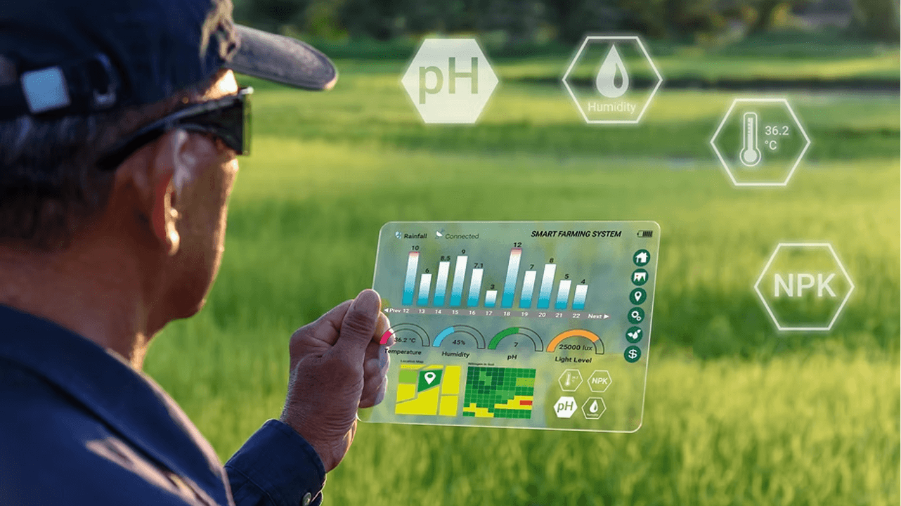
eFarming is a precision agriculture approach that uses satellite imagery and remote-sensing data, including vegetation indices such as NDVI and NDRE, to monitor crop performance, identify stress zones, and support improved field decisions. Although it still depends on agronomic expertise for interpretation, it enables farmers to respond earlier and manage fields more precisely.
As agriculture is under growing pressure to increase production with fewer resources, data-driven solutions are becoming increasingly vital in day-to-day farm management. According to a review published in Smart Agricultural Technology, precision agriculture technology has been shown to increase yields by 15-20% while reducing operational expenses by 25-30%. These findings demonstrate why eFarming is becoming increasingly valued as a practical solution to boost efficiency, decrease waste, and enable more informed farm management.
How INO Nature Uses eFarming in the Field
INO Nature’s agronomists utilise a three-step procedure to convert satellite data into practical field decisions. Rather than depending solely on visual observation, INO Nature employs eFarming as a diagnostic tool to narrow down what is happening in a field before visiting it on-site. This underscores a basic premise of eFarming: technology does not replace agronomic experience, but rather helps to focus it more precisely.
Source: Earth Foods
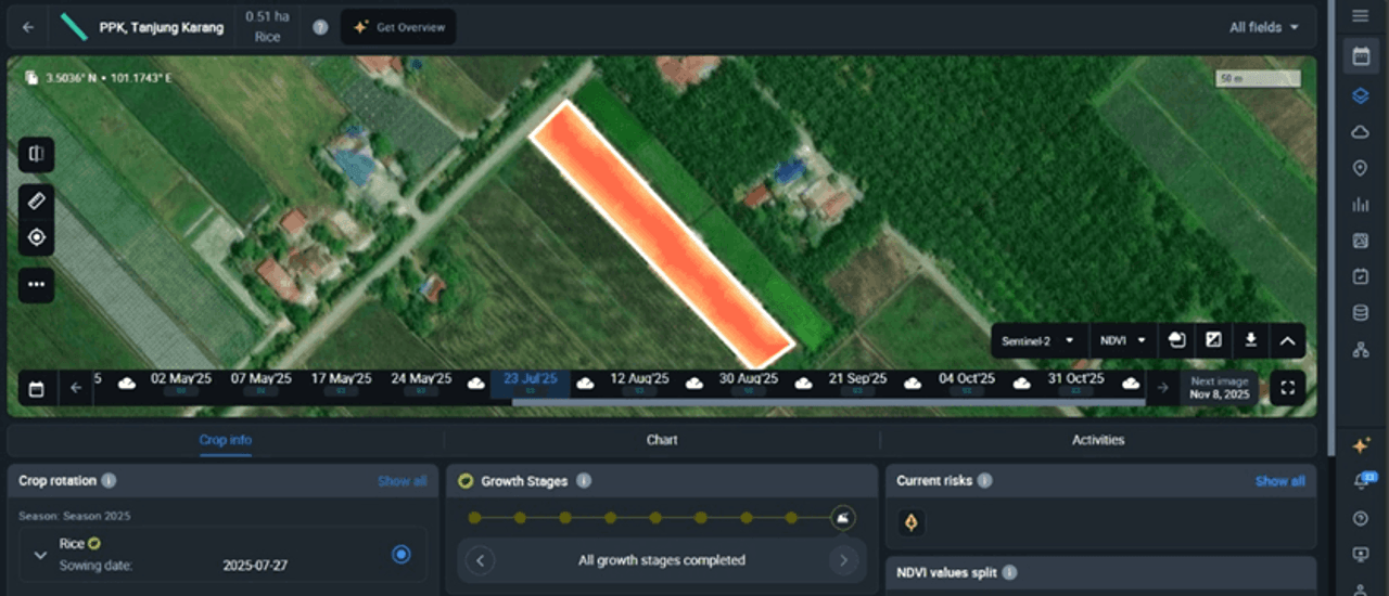
The process starts with evaluating Sentinel-2 satellite imagery using NDVI colour mapping. Green zones often indicate stronger chlorophyll activity and healthier canopy development, whereas yellow-to-red zones show areas with weaker vegetation that may require additional attention. Agronomists determine where these differences occur, how widespread they are, and whether they correspond to certain topographical features or field patterns. Research shows that Sentinel-2 NDVI time-series become more useful for agronomic management when interpreted together with landscape position and topographic data.
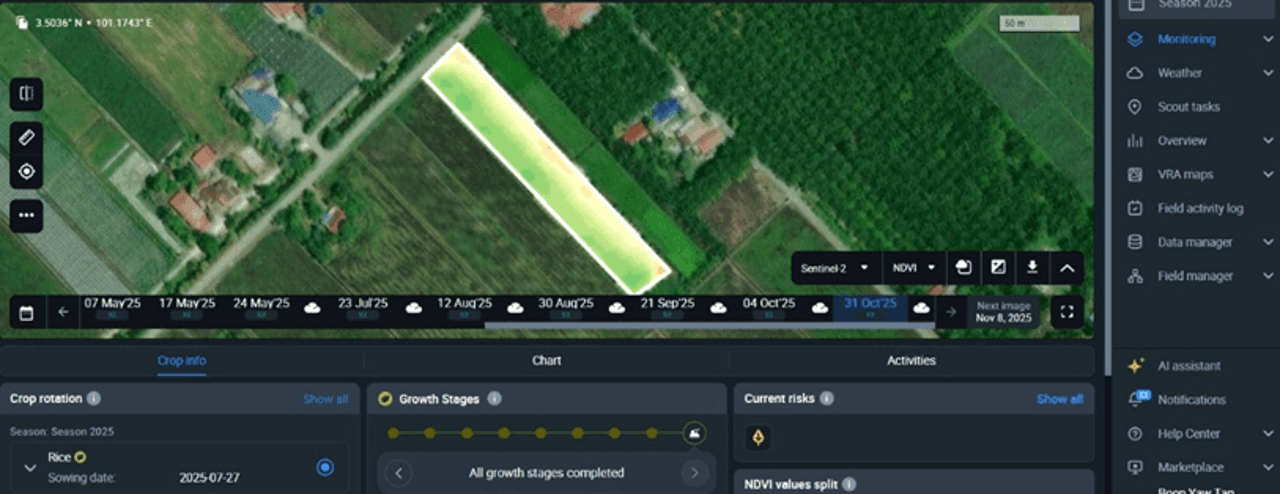
Once weaker zones are identified, agronomists study satellite photos from various dates to see how they change over time. This distinguishes a persistent structural issue from a temporary fluctuation caused by weather or a one-time field event. If the same weak zone appears numerous times, it is more likely to indicate an underlying constraint that requires more examination. This is crucial because a 2025 study discovered that unstable yield zones encompassed approximately 47% of the cropland in the area examined, emphasising the significance of distinguishing between persistent stress and temporary variation.
The final phase is on-site field verification. INO agronomists visit the marked zones in person, using satellite imagery to guide their search. They then determine whether the problem is due to waterlogging, uneven nutrient distribution, pest or disease pressure, or ineffective field management approaches. Satellite data can suggest where a problem may exist, but field experience is still required to assess the most likely cause and recommend a site-specific response.
How INO Nature’s eFarming Service Supports Larger Plantations and Estates
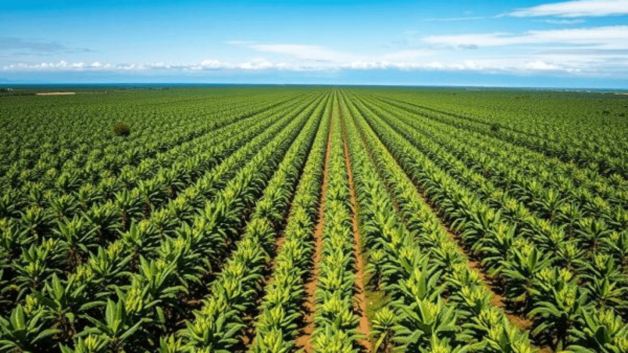
INO Nature’s eFarming service is especially suitable for larger plantations and estates of 100 acres or above, where monitoring crop conditions across a wide area can be time-consuming and labour-intensive. By combining satellite-based field monitoring with agronomist support and on-site consultation, the service helps identify areas that require care before a thorough manual inspection is carried out. This increases the effectiveness of field monitoring and enables teams to concentrate on areas that are more likely to need intervention.
For farmers managing larger land areas, this can support both earlier detection and longer-term cost efficiency. Weak zones can be identified earlier, potential issues can be investigated before they escalate, and field trips can be better prioritised. Over time, this promotes more balanced fertiliser use, reduces unnecessary input application, and improves overall estate decision-making.
Why Agronomist Experience Is Still Essential
Satellite imagery and vegetation indices such as NDVI and NDRE can help identify weak zones, stress signals, and unusual field patterns, but they cannot explain the specific cause on their own. In Malaysia, where farming conditions are influenced by tropical rainfall, uneven terrain, and a diverse range of crop systems, the same stress pattern can indicate very distinct underlying problems. In durian farms, for example, uneven rainfall and drainage conditions might lead one section of a plot to react differently than another, even within the same planting block. A decrease in vegetation performance could be caused by nutrient imbalance, drainage issues, pest pressure, disease, or regular crop-stage changes. This is important in a country where agriculture remains economically significant: Malaysia’s agriculture sector generated RM186.43 billion in income in 2023, with the crops subsector accounting for RM132.06 billion (70.8%) of total income.
That is why agronomic experience is critical. INO Nature evaluates satellite signals alongside crop type, field history, soil condition, fertiliser records, and local growth conditions in Malaysian agricultural systems including durian orchards, rice fields, vegetable farms, and mixed-cropping areas. This practical judgement is especially relevant as Malaysia’s agricultural research ecosystem continues to develop precision and smart farming capabilities through institutions like MARDI, which focuses on dedicated work in precise and smart agriculture, including decision-support and field-level precision technology. This highlights precision farming approaches that reduce the use of inputs such as seeds, fertilisers, and pesticides while lowering environmental impact. In practice, satellite data indicates where to look, while agronomic experience determines what the signal means and what response is most appropriate.
How eFarming Supports Precision Fertiliser Use and Living Soil Management
eFarming supports precision fertiliser use by helping agronomists assess how crops respond after an application, identify weak zones, and determine where further uniform fertiliser application may not be required. Instead of treating the entire field the same way, satellite-based field monitoring allows you to identify where growth is strong, where it is lagging, and where soil or nutrient constraints may be affecting performance. This aligns with a living soil approach to farm management, in which nutrient efficiency, crop performance, and soil remediation are viewed as interconnected goals rather than separate outcomes.

This approach also connects naturally to INO Nature’s fertilisers in practical field scenarios. If eFarming shows that certain zones are falling behind during the vegetative stage, agronomists can determine whether more balanced growth support is required. If weaker performance appears during flowering or fruit development, the focus may shift to products suitable to those stages, such as INO Nature’s Classic Series, including CG, CB and CR, whereas BOCF supports crop growth while also preserving soil. When on-site inspections suggest problems such as poor plant vigour, root stress, pH imbalance, or disease pressure, foliar and treatment products can also help with the response. Rather than applying inputs uniformly, eFarming helps guide more targeted decisions based on what is happening in each part of the field.
The Value of INO Nature’s eFarming Approach for Farmers
For farmers, the value of eFarming lies in making more precise and evidence-based field decisions. By combining satellite monitoring and agronomic interpretation, INO Nature can create clearer baseline profiles for each field, identify limiting zones earlier, and provide recommendations based on real crop response rather than general assumptions. This helps farmers reduce wasteful fertiliser use, enhance input efficiency, and gain a better understanding of how soil condition, crop performance, and field variability are related.
Beyond immediate crop performance, this approach also supports a more responsible way of managing land. This also reflects the principle of Fair Trade for Living Soil, where productive agriculture is balanced with long-term soil care. As fertiliser use becomes more targeted and field conditions are better understood, farmers are in a stronger position to reduce waste, avoid unnecessary inputs, and care for soil health over the longer term. In this way, eFarming promotes not only better decisions for the current season, but also the broader principle that productive agriculture should coexist with the preservation of living soil for future generations.
INO Nature offers eFarming in Malaysia as a service that combines satellite-based field monitoring with agronomist support and on-site consultation. It is especially useful for larger plantations and estates as it can help reduce manual inspection effort, improve visibility across the field, and support earlier, more focused action where necessary. This allows farmers to manage field variability more efficiently and make better-informed decisions for long-term performance.
- Sign Up Now